|
|
|
Main Index | 2000 Index | Current Cyclones
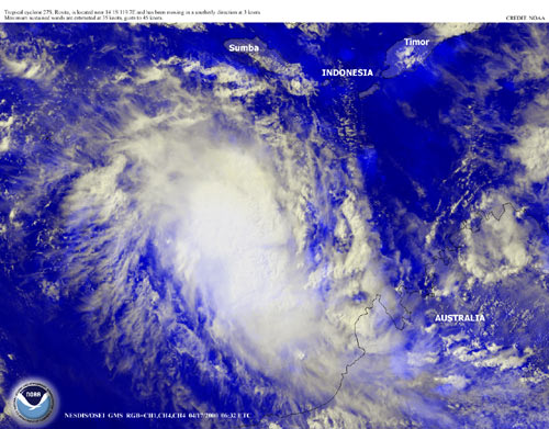
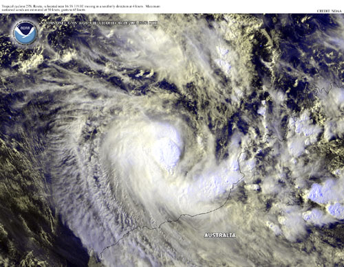
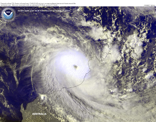
Below is a series of satellite image previews showing the passage of TC Rosita towards Broome in North Western Australia.
Each of the images is linked to the full size images on the National Oceanic and Atmospheric Administration Operational Significant Event Imagery server.
The full size images are quite large, usually over 500 K, but the quality is excellent.
Click on an image to download the full version.
The two infrared images below are from the
NPMOC Satellite Image server
and have false colours applied
with white-blue being 'hot' and red-black being 'cold'.
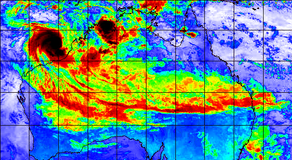
TC Rosita's outflow 'tail' spanning Australia
18th April 15:31 UTC
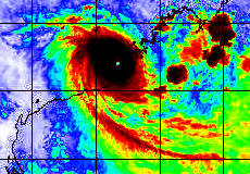
TC Rosita Approaching Broome
Main Index | 2000 Index | Current Cyclones
Maintained by Carl Smith.
carls@ace-net.com.au
© Carl Smith 1999 - 2000. All maps, images, and other information on these Web pages is copyright, either by Carl Smith, or by the agencies that produce the satellite images and other weather related information, as indicated in each case. It is essential to obtain permission in writing from the copyright owner before reproducing any of the information on this website in any form whatsoever except for fair purposes of review as permitted under copyright legislation.
DISCLAIMER: Carl Smith is not responsible or liable in any way whatsoever for the manner in which any person, group, or business, chooses to use the information in this website or the consequences thereof. Whilst all due care is taken to ensure the accuracy of the information contained herein, there may be errors, and the information here is not necessarily up to date. All persons are reminded that it is essential to obtain current information from relevent authorities regarding current or potential cyclones.